Introduction

The Noun Project - Gigih Hardhia
“Every year, exposure to air pollution is estimated to cause 7 million premature deaths and result in the loss of millions more healthy years of life. In children, this could include reduced lung growth and function, respiratory infections and aggravated asthma. In adults, ischaemic heart disease and stroke are the most common causes of premature death attributable to outdoor air pollution and evidence is also emerging of other effects such as diabetes and neurodegenerative conditions. This puts the burden of disease attributable to air pollution on a par with other major global health risks such as an unhealthy diet and tobacco smoking.”, WHO Global Air Quality Guidelines, https://www.who.int
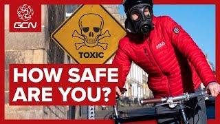
Healthier Pathways 4 Active Travel[1]: aims to raise awareness of the adverse impact of poor air quality on the health and wellbeing of those engaged in active travel (cycling and walking) and how this can be mitigated by adopting routes that have the best air quality.
The module asks learners to map their own green routes along rivers, canals, parks, disused rail tracks or if on road in bike lanes or roads that are less busy. By doing so, It actively encourages cyclists and walkers to find the best routes for air quality to go about their business for work, learning or leisure.
[1] “Active travel means making journeys by physically active means, like walking or cycle”, Active travel: Trends policy and funding, 7 August 2020, research briefing, https:// commonslibrary.parliament.uk
Task

Photo by Gemma Evans on www.Unsplash.com
1. To map three active travel routes in your town / city for avoiding routes that have high concentrations of poor air quality.
2. To undertake a light touch review of literature (reports and studies) that highlight the impact of poor air quality on peoples’ health and wellbeing to produce a short one page fact sheet detailing your findings.
3. To make a light touch assessment of the most polluted parts of your town and city by accessing data sources – which will, typically, be found along arterial routes and ring roads or in areas that have a concentration of industry.
To map:
- one route that is in your immediate neighbourhood (where you live) for example to a access your local shops within 2-4km of your home;
- one route that takes you into your city or town centre (or vice versa if you live in the centre and want to travel to a suburban area within 3-6km
- one route that takes you into an an out of city location within 5-20km.
4.To describe your routes with a drawing (use a blank map) and write up some basic route instructions (you can draw on walking and cycling route instructions)
Process
You should begin by doing desk research on air quality in terms of the issue generally as well as specifically in your town or city. You can access this through doing a search for air quality information / air quality index for Europe, your country and your city. You can access information in particular from the World Health Organisation (WHO global air quality guidelines (apps.who.int)
A. Produce a short assessment of air quality of your town and city:
- How does it compare with other similar size towns and cities in terms of air quality assessments? Look at comparators for a town or city in your region, another region and a European country)
- What is the picture across your town or city – is it possible to identify particular parts e.g. main arterial routes, main shopping centres, industrial parks where there is poorer air quality?
- Is it possible to identify particular times of the day when air quality is at its worse in these areas?
- Run off a map (preferably A3 OR a2), of your town and city. Shade in parts of the city with the highest average poor air quality scores in red; those with medium scores amber and those with low scores green. Note if the time of day has a bearing and produce one map for commuting (between 8-10am and 4 and 6pm) timings and different parts of the year mean these scores vary so you could produce 2/3 sets of maps for the commuter times (8-10) and (3-6) and mid am and mid pm.
B. Development of your 3 active travel route plans.
Run off 3 further maps of your city or town to map your journeys. You can also use software packages such as Mapbox to download map templates and draw your routes. Taking advantage of green corridors along rivers and canals, parks or bike lanes along less busy roads and your mapping of air quality draw and describe your routes producing a line by line direction guide (see typical walking or cycling guides). Following your mapping of the routes, undertake a trial testing of each of the routes and draw up a personal record of your experience. Reflect on the air quality, the impact on your wellbeing, the journey time.
You could down load an air quality app or borrow or purchase a mobile air quality monitor (typical purchase price is around €100) which would give you real time feedback on air quality. Reflect at the end of your journey on these scores (you should log them on your journey) and compare them to your initial mapping.
Conclusion
The learners will have experienced and acquired knowledge, skills, competencies on the key issue of air quality in towns and city and the importance of mobility that promotes wellbeing and minimising the impact of poor air quality. Learners will have got to grips with the issue through their air quality assessments into the issue in general and specifics in their city, worked with data to map and produced different route types that would be typically used by cyclists within towns and cities
Evaluation
Learning Objectives
- • Understanding of the impact of air quality on health and wellbeing
- • Understanding of the positive impacts of active travel even when air quality is poor
- • Understanding benefits of cycle and walking routes using green corridors or co cycling/motoring bike lanes
Knowledge
- • Undertaking a literature review and desktop research
- • Understanding of mapping data and translating data into route maps that avoid poor air quality
Skills
- ● Mapping and data analysis
- ● Using apps and tech for guiding cycling and better cycling competencies and the highway code
- ● Measuring air quality with apps and mobile tools
Attitude
- ● Cycling proficiency
- ● Map and route reading
Resources
Click each section below to see all resources available.
Resources
Click each section below to see all resources available.